Bend Development of the Padma River
Bend Development Process
Meanders are the result of erosion-deposition processes tending toward the most stable form in which the variability of certain essential properties is minimized and this minimization involves the adjustment of the planimetric geometry and the hydraulic factors of depth, velocity, and local slope. Bend development process is very active in the major rivers in Bangladesh. It is well explained by Hooke description. There are different kinds like extension, translation, rotation, enlargement, lateral movement and combinations of these as shown in figure below.
Bend Development of the Padma River
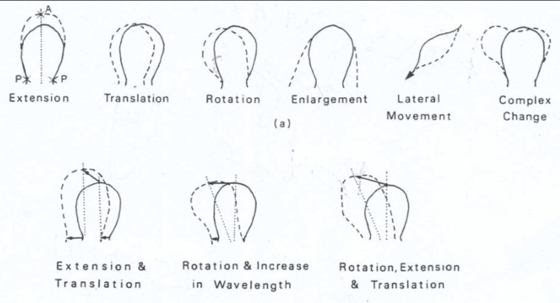
The Padma is a meandering but it also shows the river planform between meandering and braided rivers. It is a highly dynamic river but less energy than the Kosi River. However, it is important to relate to the theory with the observed situation. For the assessment of the bend meandering process with relation to relate the particular or combination of the Hooke’s type, Harirampur bend of the Padma River is the best example. It lies along the left bank of the River just d/s of the Paturia ferry ghat.
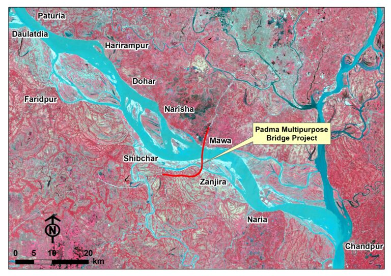
Planform Development at Harirampur
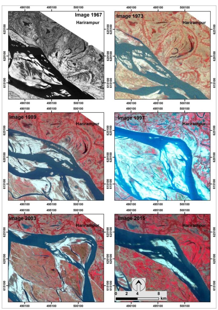
Harirampur bend is very dynamic. Time-series satellite images for the year 1967, 1973, 1989, 1997, 2003 and 2015 tells that bend migrated towards east since 1967 to the following decades until the river return to its previous years.
Lateral Bend Development
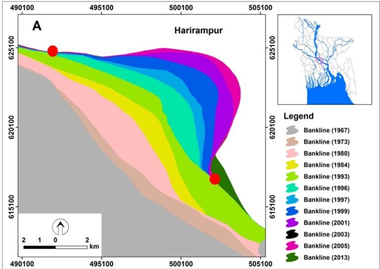
Banklines for the year 1967, 1973, 1980, 1984, 1993, 1996, 1997, 1999, 2001, 2003, 2005 and 2013 suggests that the bend shifted about 10 km towards east i.e., along the left bank during the period 1967-2013 (figure below). This bend has relation with the extension type of bend development processes by Hooke, 1977.
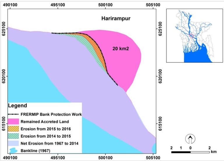
Besides, two red circles both at the u/s and d/s indicates that the bend migrated in 2014 in the western side through chute cut-off and returned to the vicinity of its position as it was in 1990s. Then, this bend again started to erode in the 2015 and 2016 (see below figure). In addition to that, river bank protection work at the beginning of 2016 by Bangladesh Water Development Board (BWDB) helped to accrete about 20 km2 of land.
Conclusion
It can be observed that during the period of 1996-2013, the meandering bend migrated laterally towards east by 5 km. It was also observed that the starting and ending of the bend were fixed. Based on these fixed two points, the meandering bend at Harirampur migrated. From the definition of the Hooke, 1997, it can be said that the bend has Harirampur migrated by extension bend development process. Therefore, bend development at Harirampur could be related with the theory of the Hooke’s definition made in 1977.
