Incidence Map-Jamuna
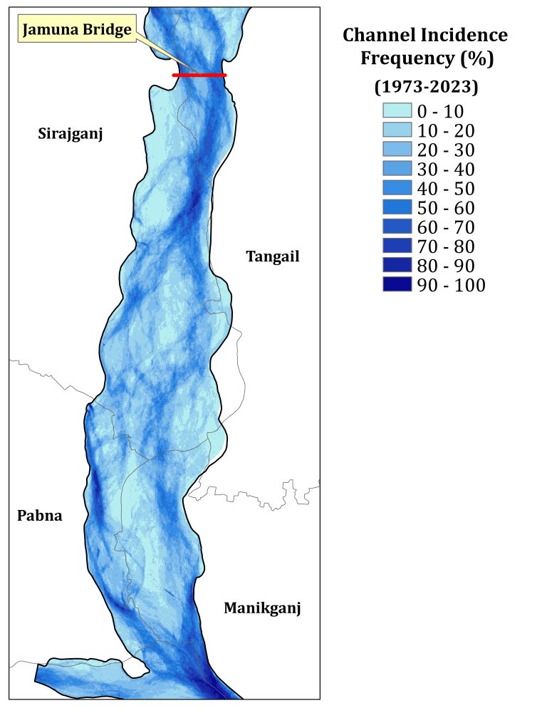
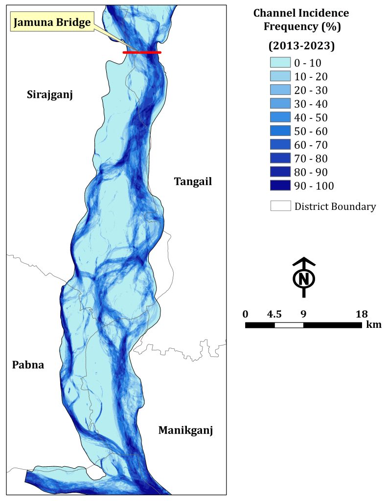
The Jamuna River is one of the braided rivers in the world. It is very dynamic due to the chaotic behaviour of the channel pattern. It changes its course frequently. The abandonment/development of the channel is very frequent. It is more dynamic than the Padma River. Channel Incidence map is very useful for designing and planning for water resources management.
A map of the Jamuna River helps to assess the appearance of the channels downstream of the Jamuna Bridge. Dry season satellite images from 1973 to 2023 were classified into land, sand, and water using remote sensing techniques. Then, the water part of each year is taken into insideration to prepare the map. For a better understanding, the percentage of the channel incidence frequency has ten (10) classes with an interval of ten (10). It has been not easy to assess a defined course of the channel in the last 50 years. This illustrates the dynamics of the Jamuna River.
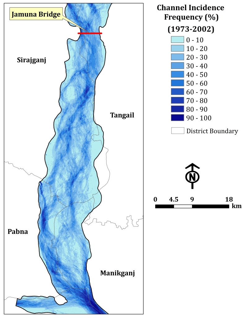
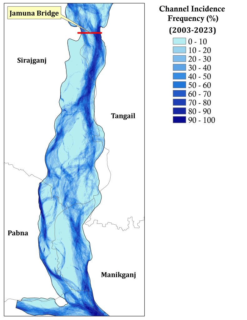
Furthermore, the total study period has two parts. One is from 1973 to 2002 and another is from 2003-2023. However, it is obvious that the river becomes very chaotic in the part of Lower Jamuna River from the Jamuna Bridge to the confluence with the Ganges River as it is tough to identify a clear path of the channel from the period from 1973 to 2002.
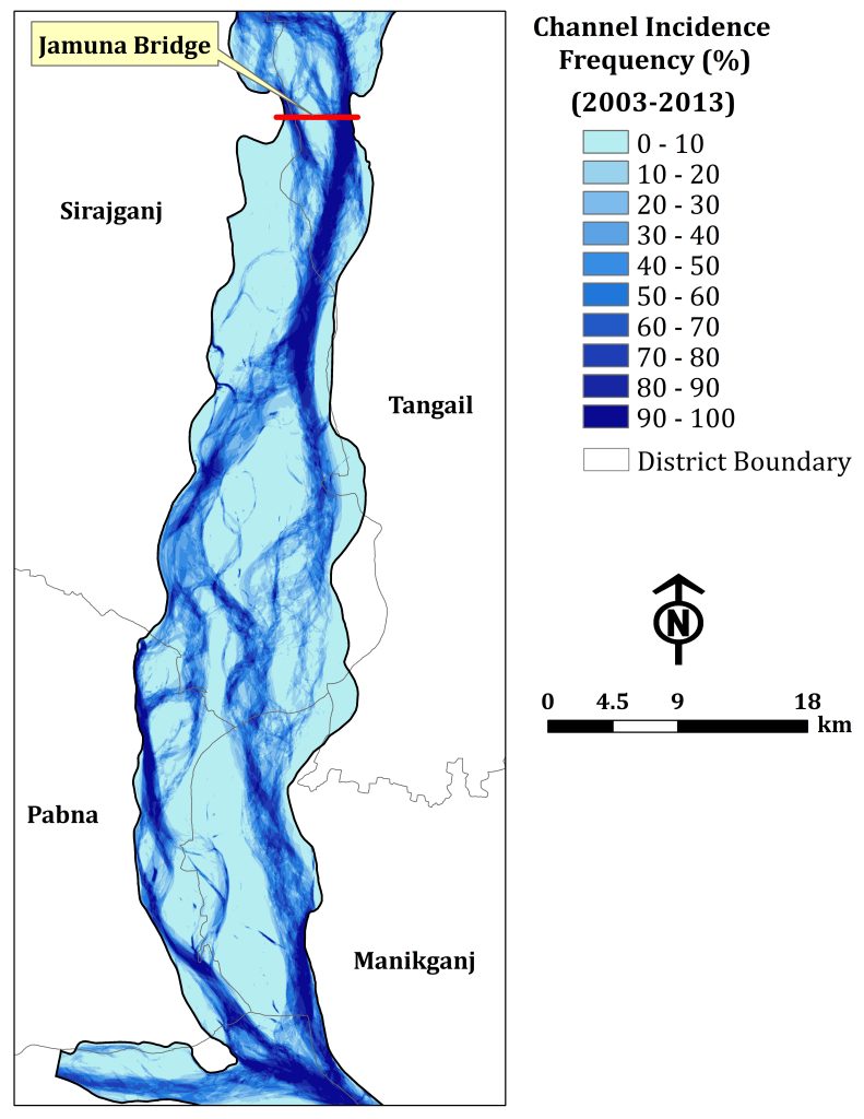
While two distinct anabranching channels exist from the period of 2003-2023. In addition to that, to know more characteristics of the anabranching channels, the figure has been prepared on a decadal basis from 2003 to 2013 and from 2013 to 2023. Two time periods show two well-defined behaviours of the channel. The right anabranching channel became more active during 2003-2013 while the left anabranching channel became more active compared to the right during 2013-2023. This indicates that the anabranching channel itself behaves differently over time.
This section mainly gives information of the Jamuna River at the immediate upstream of the Jamuna Bridge. It provides the detailings of the channel from 1973 to 2020 with an interval of an nearly five years. River Dynamics in 1973 River pattern in 1980 Dynamics of the Jamuna River Figures explains the fact that river…
Agro-ecology of the Barind Tract Barind Tract is one of the important agro-ecological zones in Bangladesh. It is located in the NW part. The largest physiographic unit of the Bengal Basin is considered as most drought-prone area. The zone can be categorized as High, Level and North-eastern Barind Tract. Agro-ecological zone of Barind Tract Main…
The Kosi River is one of the most dynamic river in the world. It originates from Himalayas and passes by China, Nepal and India before joining with the Ganges River at Kursela, Bihar, India. The total length of the river is about 720 km. Planform Nature The planform nature of the Kosi River differs it…
Understanding of the dynamic of the confluence is very important for proper planning and management of the river. It not only change the bifurcation of the Lower Meghna River at the downstream but also it altered the shifting of the banklines along its both banks. This section provides the dynamic of the Lower Meghna River…
Bend Oscillation of the Padma River The Padma River is a very dynamic river and it has meandering bend. The bend development and bend oscillation is prominent in this river. However, it is essential to assess the type of the channel whether it is stable or actively meandering channel. Besides, time-series satellite images analysis would…
General Information of the Padma River The Padma is the most dynamic river in Bangladesh. The length of the river is about 100km. It originated from Paturia and its outfalls with the Upper Meghna River. It is a braided river. Padma carries the combined flow of the Jamuna and the Ganges Rivers. The river planform…