
The Aral Sea
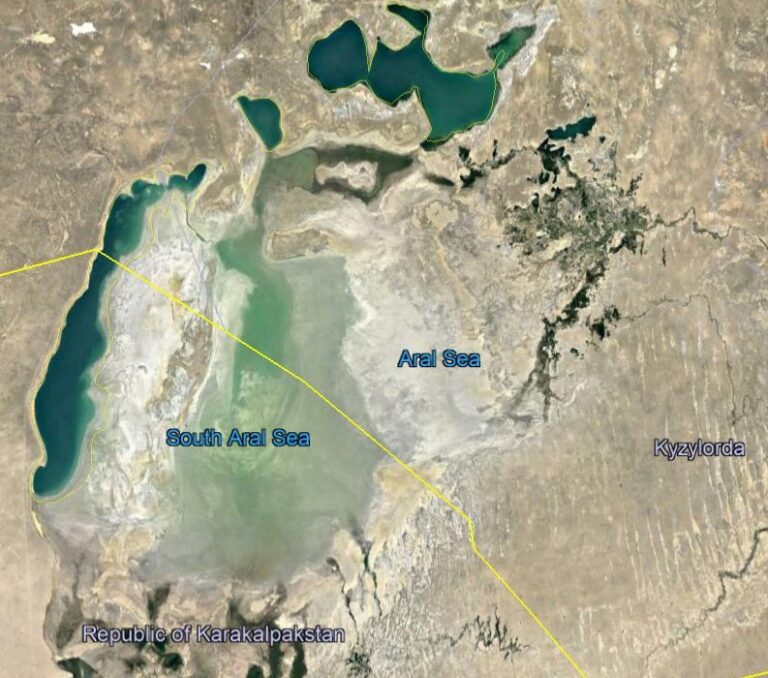
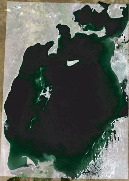
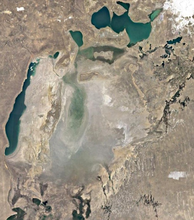
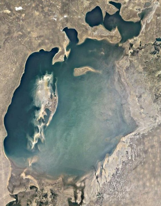
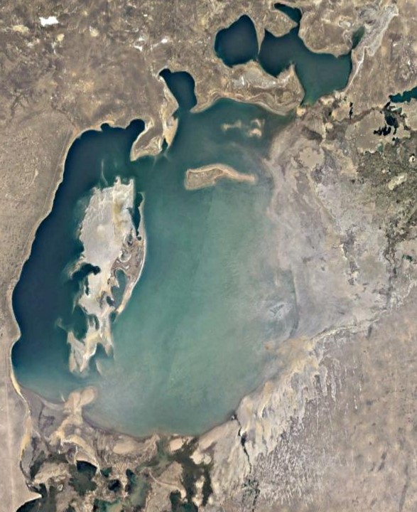
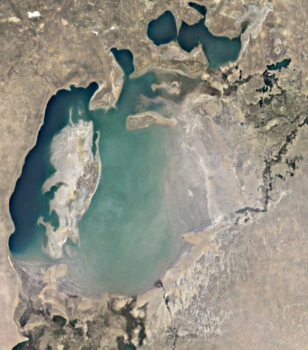
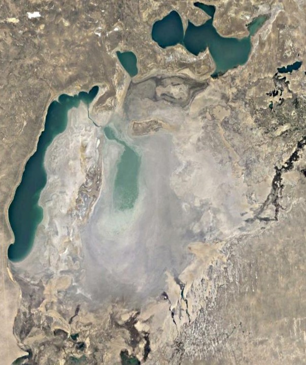
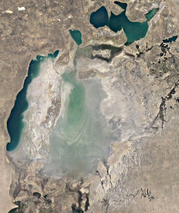
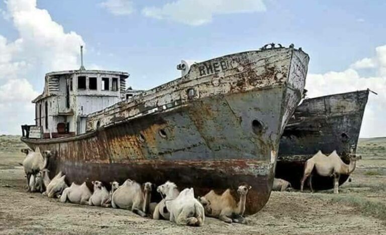
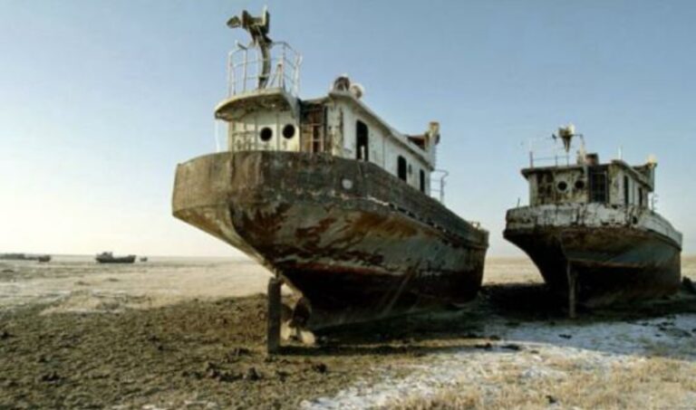
The Aral Sea lies in between Kazakhstan and Uzbekistan. The northern part of the sea is located in Kazakhstan while the southern part is in Uzbekistan. It was the fourth-largest sea in the world. But, the sea is no more the real sea now. The water area was about 60 km2 in the 1970s which has reduced to only 9 km2 now.
The changes in the sea are quite different than the rivers in the tidal area. Human interventions made this sea into a desert as a major irrigation project was executed to divert water for irrigation.
Besides, satellite images in the last five decades show that the water has reduced by roughly 7% as it was in 1973. Additionally, the eastern and southern parts become desert. The eastern part is now called the Aralkum desert. This tells that the environment of the sea declines with the ongoing tasks by a human.
Moreover, the declining effect of the sea also affects the people living around it. Reduction of the production of fish and high saline water triggers the suffering of people. Most importantly, pollution of the water by farming practices also brings health hazards and environmental degradation.
In addition to that, old ships are also present in the desert that present the condition of the sea. At the same time, the size of the ships also gives the data of the depth on the sea at that time.
However, Kazakhstan built a dam at the beginning of the 21st century to restore the lake which increases fish production.
Bend Oscillation of the Padma River The Padma River is a very dynamic river and it has meandering bend. The bend development and bend oscillation is prominent in this river. However, it is essential to assess the type of the channel whether it is stable or actively meandering channel. Besides, time-series satellite images analysis would…
Agro-ecology of the Barind Tract Barind Tract is one of the important agro-ecological zones in Bangladesh. It is located in the NW part. The largest physiographic unit of the Bengal Basin is considered as most drought-prone area. The zone can be categorized as High, Level and North-eastern Barind Tract. Agro-ecological zone of Barind Tract Main…
This section mainly gives information of the Jamuna River at the immediate upstream of the Jamuna Bridge. It provides the detailings of the channel from 1973 to 2020 with an interval of an nearly five years. River Dynamics in 1973 River pattern in 1980 Dynamics of the Jamuna River Figures explains the fact that river…
General Information of the Incidence Map The Jamuna River is one of the braided rivers in the world. It is very dynamic due to the chaotic behaviour of the channel pattern. It changes its course frequently. The abandonment/development of the channel is very frequent. It is more dynamic than the Padma River. Channel Incidence map…
Understanding of the dynamic of the confluence is very important for proper planning and management of the river. It not only change the bifurcation of the Lower Meghna River at the downstream but also it altered the shifting of the banklines along its both banks. This section provides the dynamic of the Lower Meghna River…
General Information of the Padma River The Padma is the most dynamic river in Bangladesh. The length of the river is about 100km. It originated from Paturia and its outfalls with the Upper Meghna River. It is a braided river. Padma carries the combined flow of the Jamuna and the Ganges Rivers. The river planform…